I played Warcraft 3 as a kid and just the other day I picked up the campaign again. With Mila to help me get good, I set off to Azeroth, and it was a fantastic time.
One thing I took special notice of were the maps that Blizzard put on the loading screen before every mission. These things are absolutely beautiful. They not only show where the game’s missions are in the imagined world, but how the characters move from one to the other, and even totally unrelated background elements that set off my “Lore!” button.
Then I picked up Warcraft 2 for the first time. It’s also pretty amazing. It has beautiful maps before each act of its two campaigns, and an even prettier map in its manual.
Naturally, I thought, how do these fit together? And if they don’t, can I make them fit together? And, hey, while I’m at it, might as well see how it looks in comparison to the real world too, right?
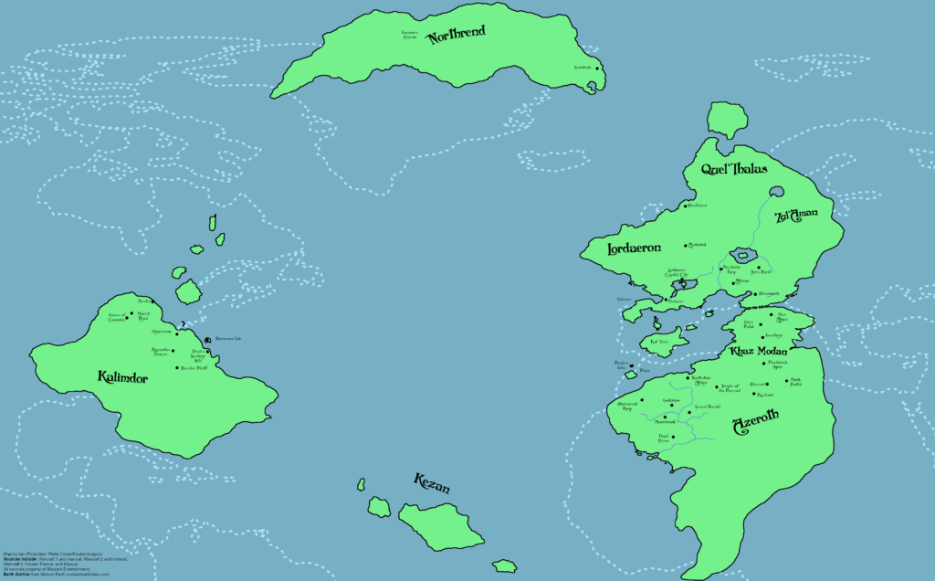
Well, I made this to find out:
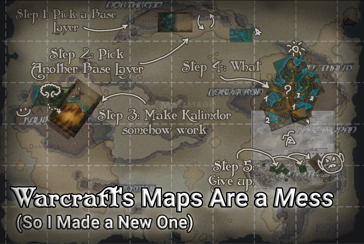
To get from nothing to this I needed to a few things. Starting with finding a large-scale map of all of Azeroth’s continents. That, fortunately, was pretty easy. I found a bunch, but every single one differed completely from all the others. Off to a fantastic start, right?
The World
I needed to make a choice. I made the wrong one. The biggest differences between every map of the Warcraft world are in the western continent of Kalimdor. This should surprise, because Kalimdor didn’t exist before Warcraft 3!
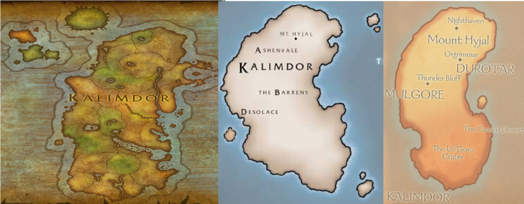
Source: WoWpedia and ScrollsofLore.com.
It is ugly in all of them. Really, really ugly. But… there’s a map from pre-release Warcraft 3 where it looks really good! I went with it and then needed to solve another problem. How big is the world of Warcraft?
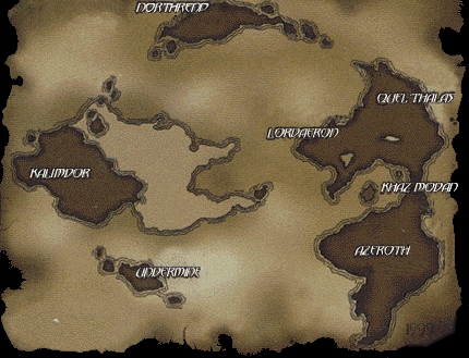
I consulted WoW and the Warcraft RPG book and decided that because the southern tip of the Eastern Kingdoms is tropical the southern edge of that map would be the equator. By the same token, the northern edge would be the north pole.
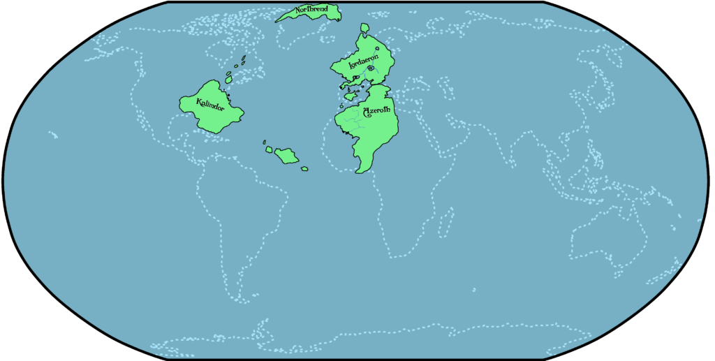
In Warcraft 3’s story it doesn’t feel like people take much longer to go from one continent to another than an early-modern traveler would take to go from Europe to America. I used that as a guide and put the western edge around California and the eastern edge around Germany. I popped all of these values into NASA’s GProjector and came up with this:
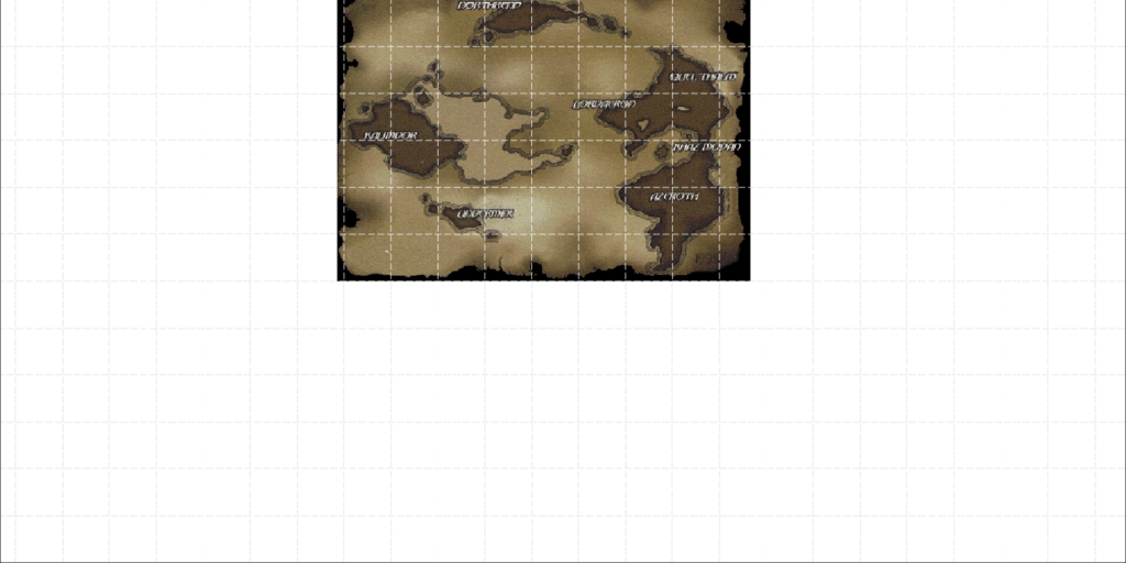
Kalimdor
But how well does that out-of-date Kalimdor fit with the maps in Warcraft 3?
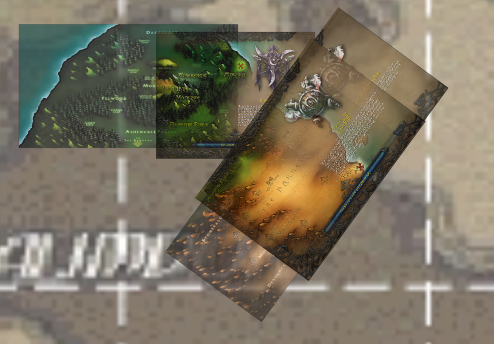
It actually does pretty well. I had to change the entire north coast, and I made the Barrens north of where Blizzard says they should be, so the beginning of the Night Elf campaign makes sense.
Northrend
Northrend, also introduced in Warcraft 3, is a very different story. It doesn’t even agree with its portrayal in Frozen Throne!
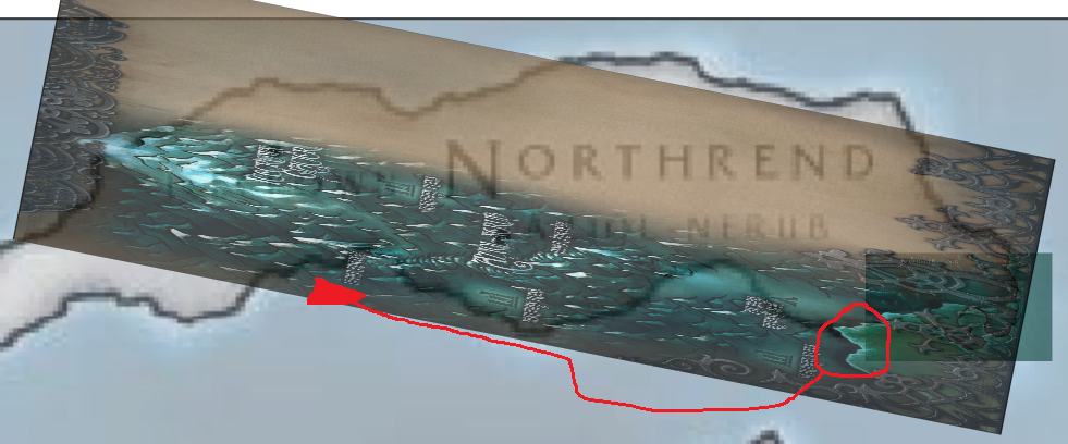
What I’m trying to do in the above image is make the rough locations of the Icecrown Glacier map in Frozen Throne match with those locations on the Northrend map that shipped with base Warcraft 3. It doesn’t work out well at all. Fortunately, the coastline does sort of match Northrend’s southern coast so I just split the difference between the locations and called it good.
Lordaeron and Stormwind/Azeroth
Now we’ve got to go deal with the Eastern Kingdoms. But before it gets terrible, let’s focus on the good. The map from the Warcraft 1 manual fits pretty well with the one from Warcraft 2. They moved Stormwind and Northshire, but otherwise it’s great!
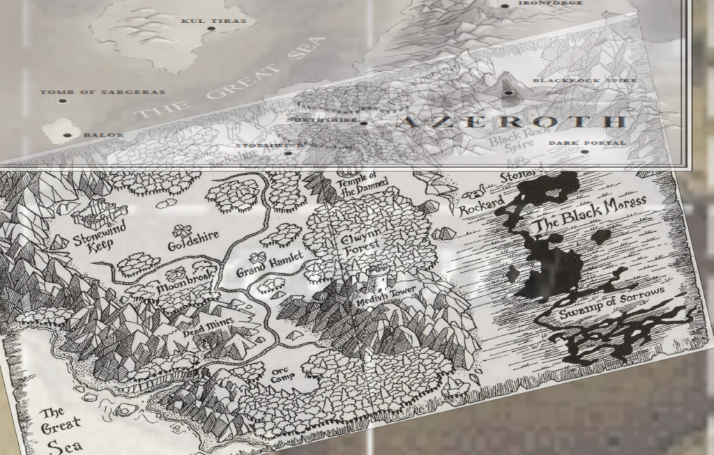
But we must come to Lordaeron. Lordaeron is a mess. Hordes of the undead rampage across its breadth and the cries of its ghosts ring off every empty steeple. The fact that it was ret-conned to hell between Warcraft 2 and 3 doesn’t help that land’s plight.
It was irreconcilable. I couldn’t make it work, so I chopped up the Warcraft 3 maps and made things fit.
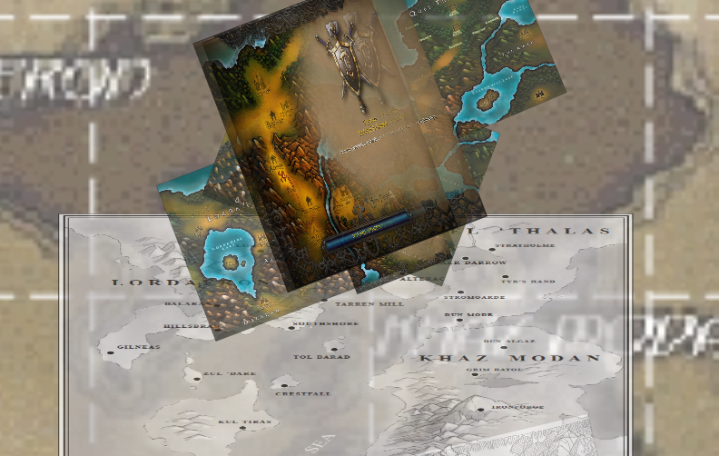
I used the location of the lakes in the continental map as a guide, and just sort of winged it. Then I put it all together with a nice thin outline, and marked all the locations. And, for the comparison, I grabbed an Earth outline from Natural Earth.
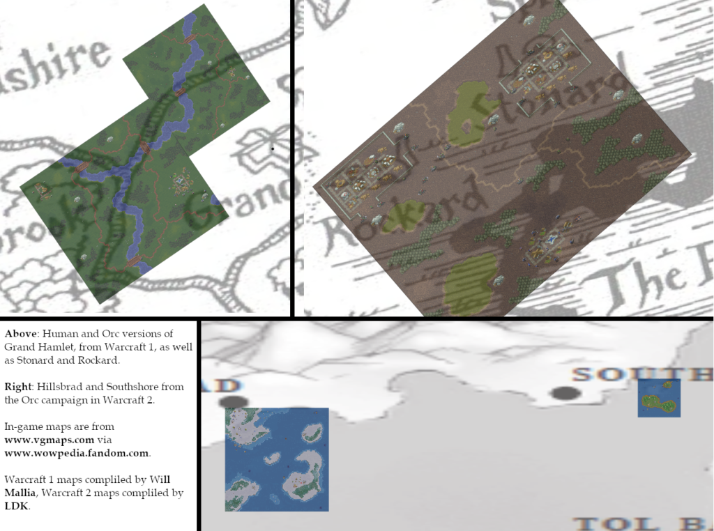
Before I could call it a day there was one last thing I needed to try. What about the actual in-game maps you play on?
Most of the maps from Warcraft 1 can be made to fit the map from that game’s manual pretty easily. The same cannot be said for the maps from Warcraft 2. I had planned on using in-game maps to mark out the locations of every gold mine and oil patch that shows up in the first three Warcraft games, but alas, it was not to be.
Wrapping Up
I finished everything up by adding rivers and adjusting the relative locations of all the continents. I wanted the Prime Meridian to run through Lordaeron City, which meant moving everything else too. I also moved Kalimdor, and Undermine/Kezan by extension, further south, so it more closely matched the route we see Thrall take across the sea in the Warcraft 3 demo.
Then I thought, I’m already doing the size comparison with the Earth, so I might as well go all out! I projected what I had into the Robinson projection, did some minor touch-ups, and called it a day.
I learned a few things from this. The first is that it is always fun to make something that persistently assumes old canon is better than new canon, no matter how much it doesn’t want to fit. The second is that Blizzard never cared about the lore, but I think all you World of Warcraft lore fans out there already figured that out.
